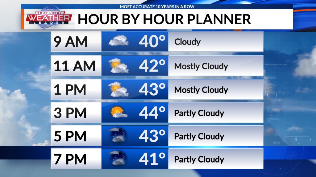
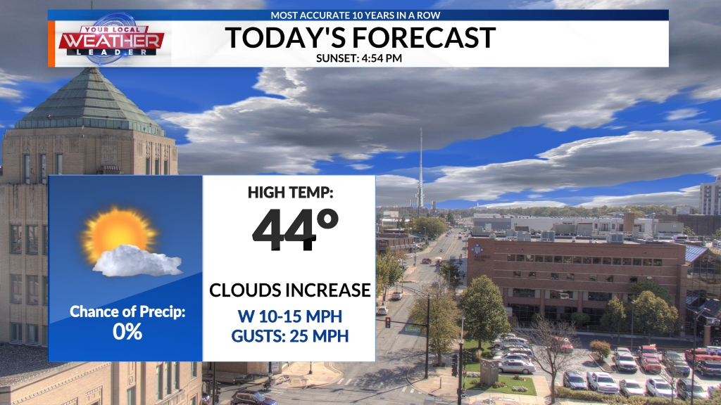
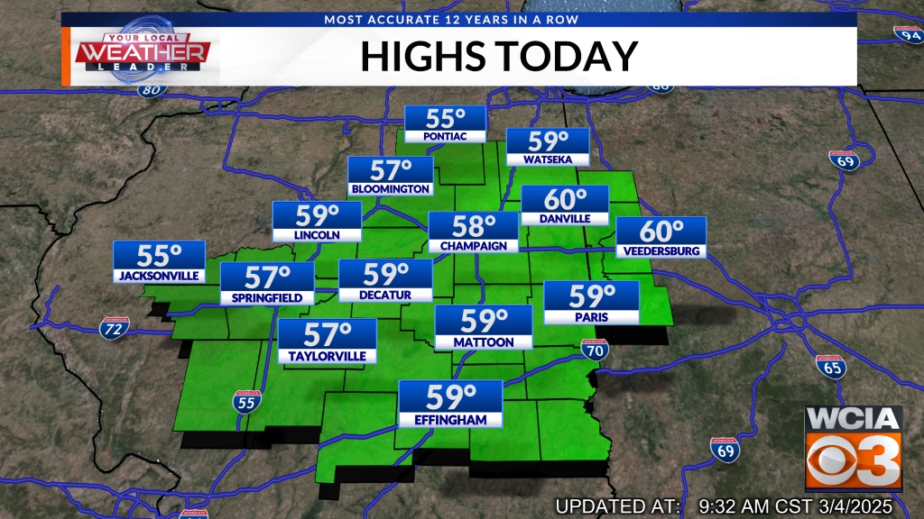
NEXT 24 HOURS:
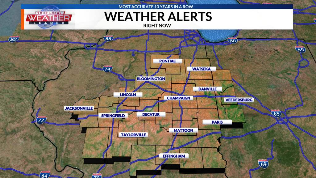
CURRENT WEATHER ALERTS:
LOCAL WEATHER FORECAST:

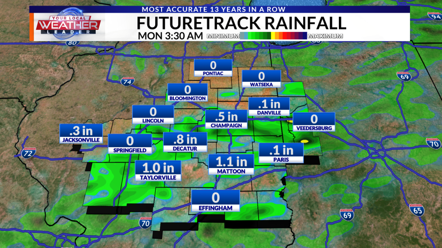
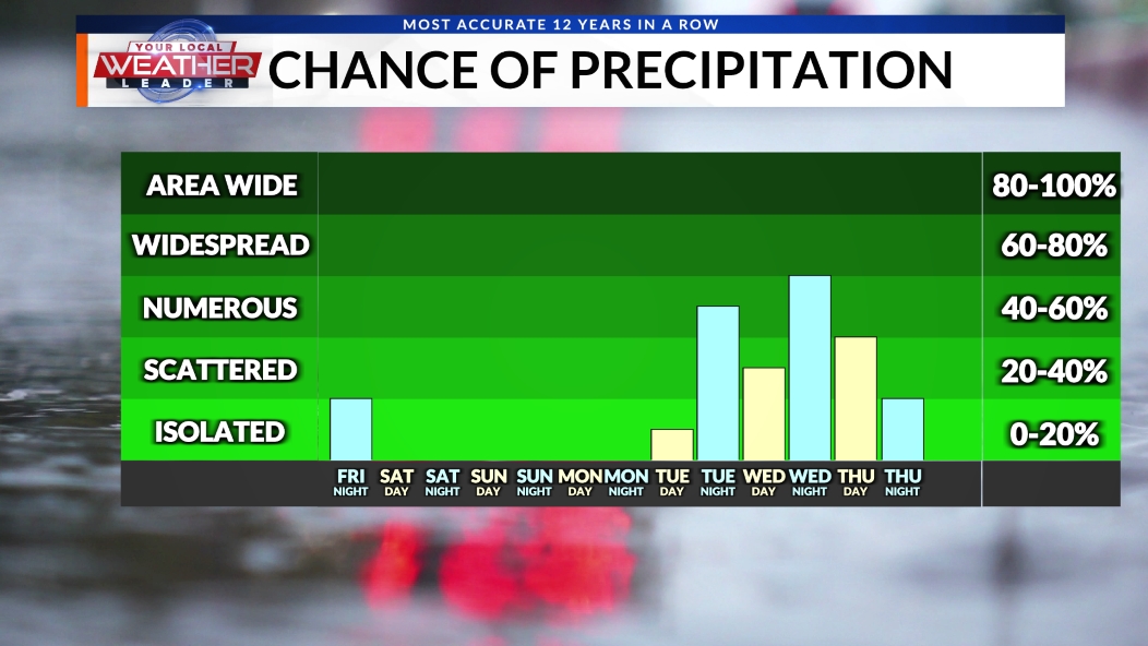
After a quiet Saturday, activity will start to pick up heading into Sunday. Although many stay dry for most of the morning, a cold front in the area will ignite some showers and storms by late this afternoon and into the evening hours. Whoever winds up with one of these storms may end up with some decent rainfall totals, but there will be quite a few folks who don't end up with too much by the end of the day. The best rain chances will be those along and south of I-72.
After that, things become very scattered throughout the work week. With the heat and humidity present every day, along with some minor support from the upper atmosphere, pop-up showers and storms will be possible during the afternoon hours for much of the week.
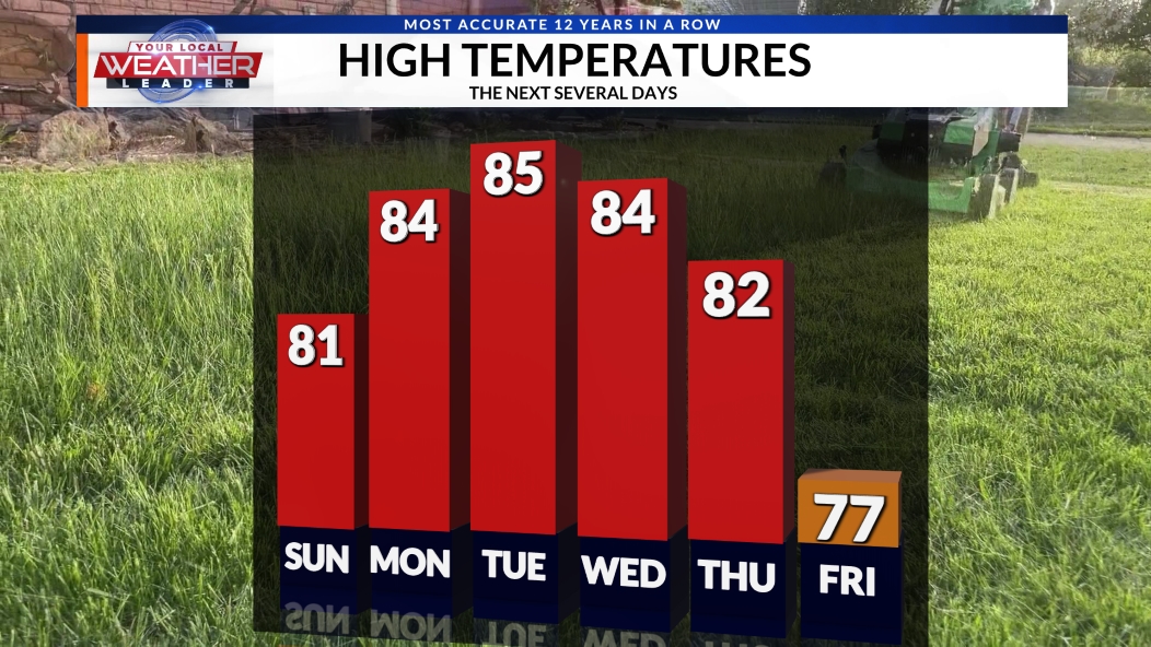
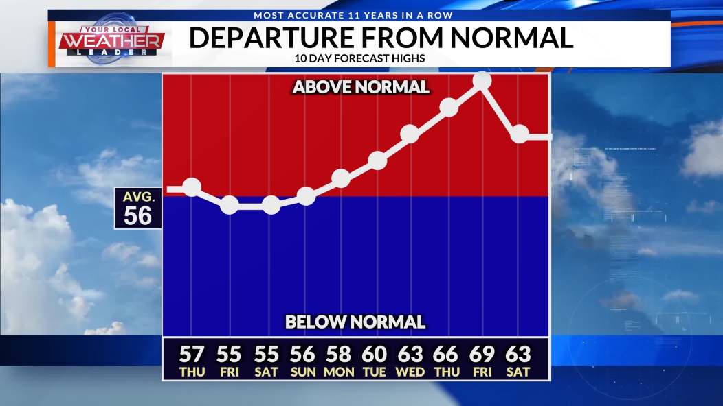
Temperatures are set to be remarkably consistent throughout the work week, with all but 1 day featuring a high of 88 degrees.
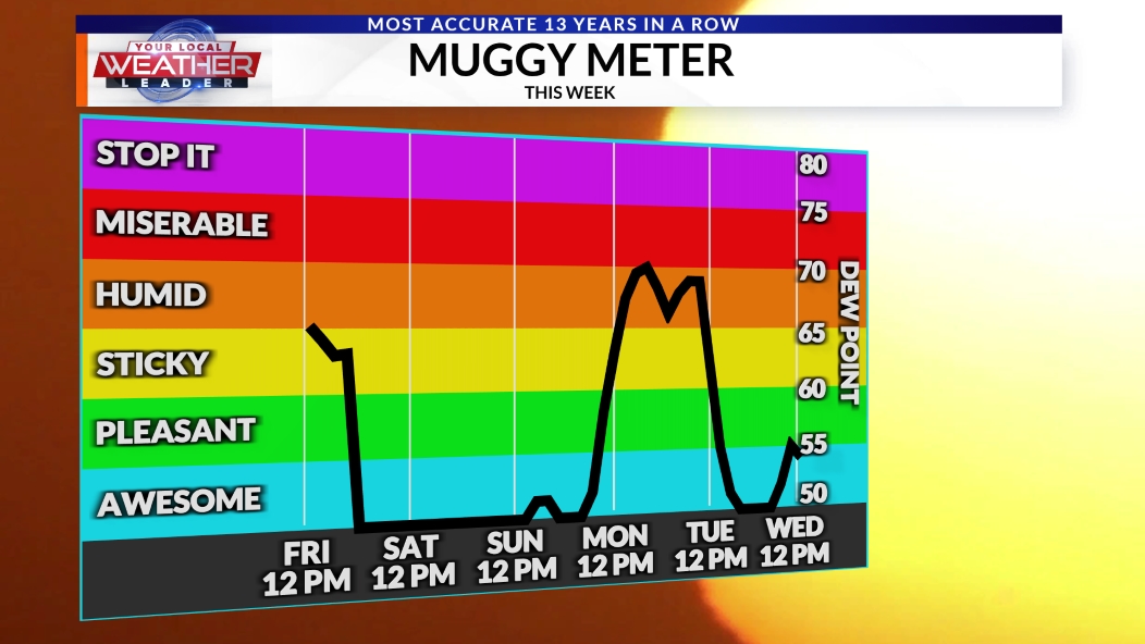
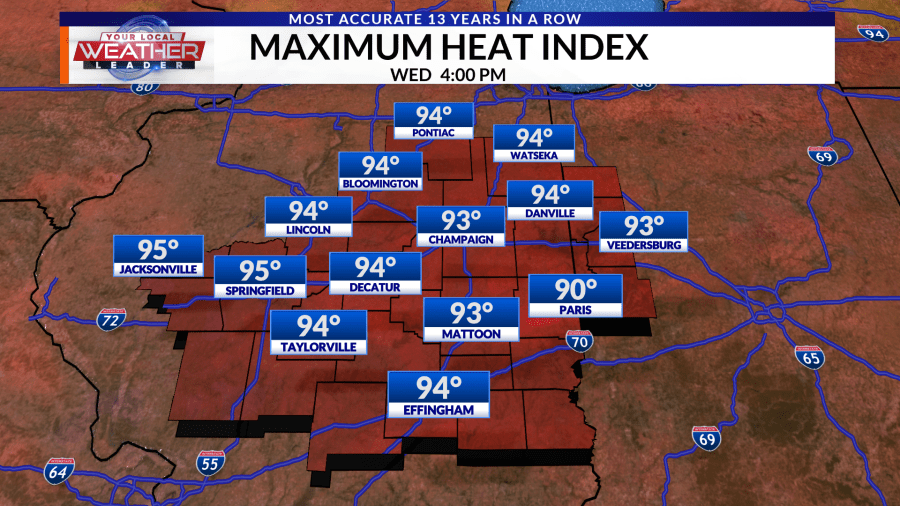
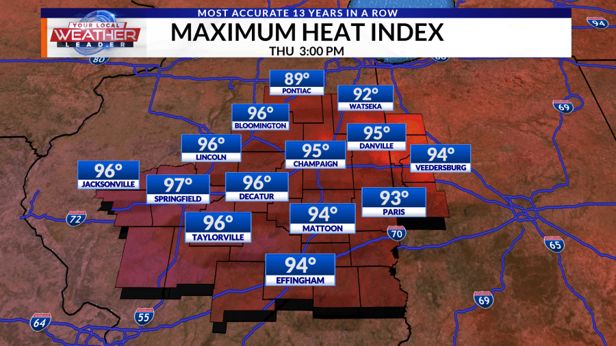
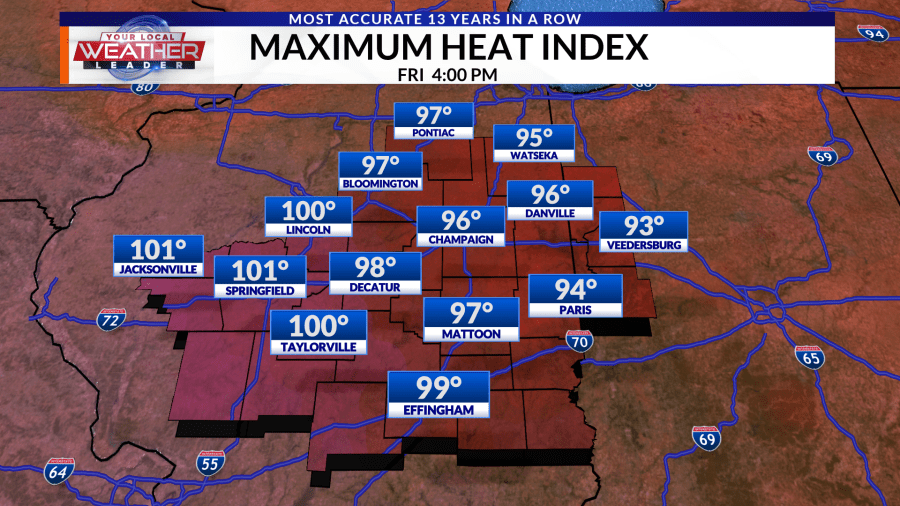
Humidity has overall decreased slightly compared to our last heat wave, but as the chance of rain increases, so will the moisture in the air. This means that heat index values could become significant again, even though actual air temperatures will be somewhat milder.
Another dome of high pressure will settle into the area this coming week, but we will be on the northeast side of it this time around. That usually means a little less heat, but a slightly higher chance of storms due to a northwest flow that could lead to more organized storm setups. We'll keep an eye on how this develops.
Even into the middle of the month, temperatures are expected to remain nearly identical from one day to the next, varying by only one or two degrees.
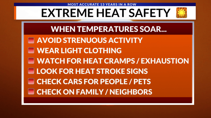
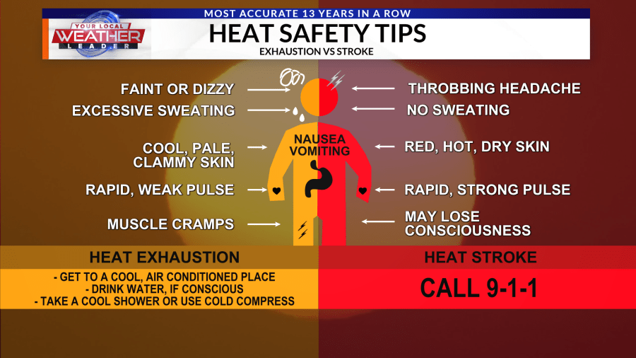
Remember heat safety and be sure to take plenty of time to rest and stay hydrated over the next few days.
With severe weather possible at any time of the year, consider using WCIA WeatherCall as a way for us at WCIA to call you in the middle of the night if a weather warning is issued for your location. When you're asleep, it's a great way to stay safe. Nothing like a phone call to wake you up and warn you and your family when minutes matter.
Don't forget to download the WCIA 3 Weather App to stay up-to-date with the latest forecast anytime, anywhere.
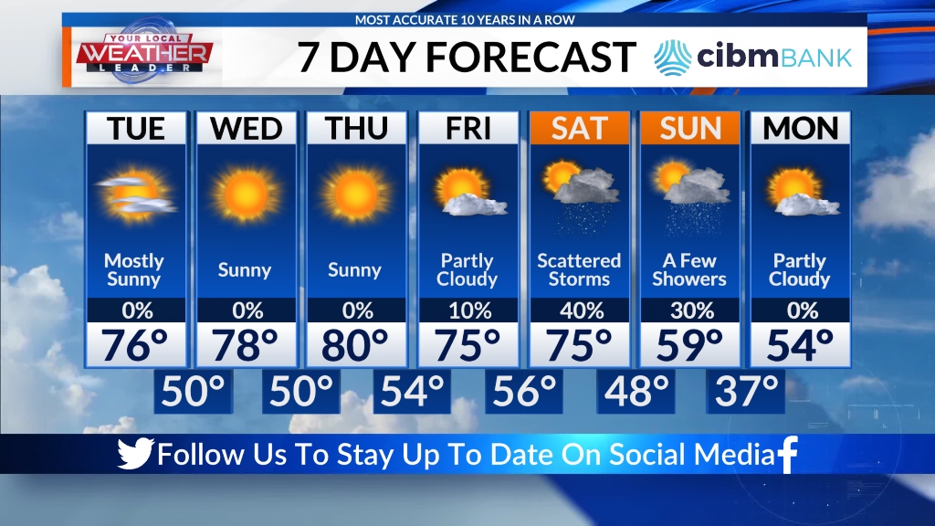
7 DAY FORECAST:
Here is your 7-day forecast, updated several times a day. You also can see the 7-day forecast and more on the WCIA 3 Weather App and in the WCIA 3 Weather Map Room.
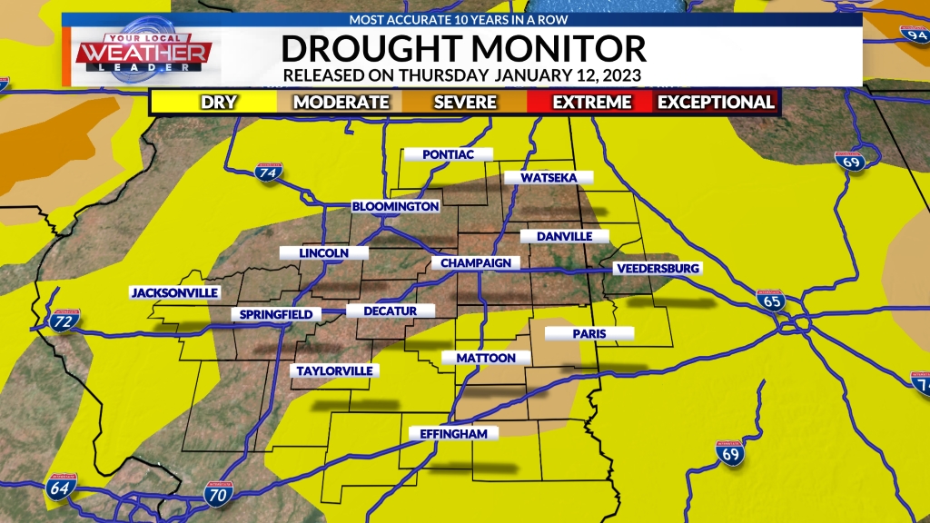
DROUGHT MONITOR:
See the latest drought monitor showing drought conditions in Central Illinois below. The drought monitor is released every Thursday morning and includes rainfall amounts from the Tuesday to Tuesday 7-day window immediately before the drought monitor is released.
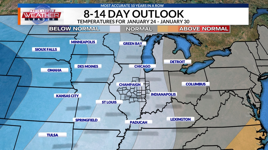
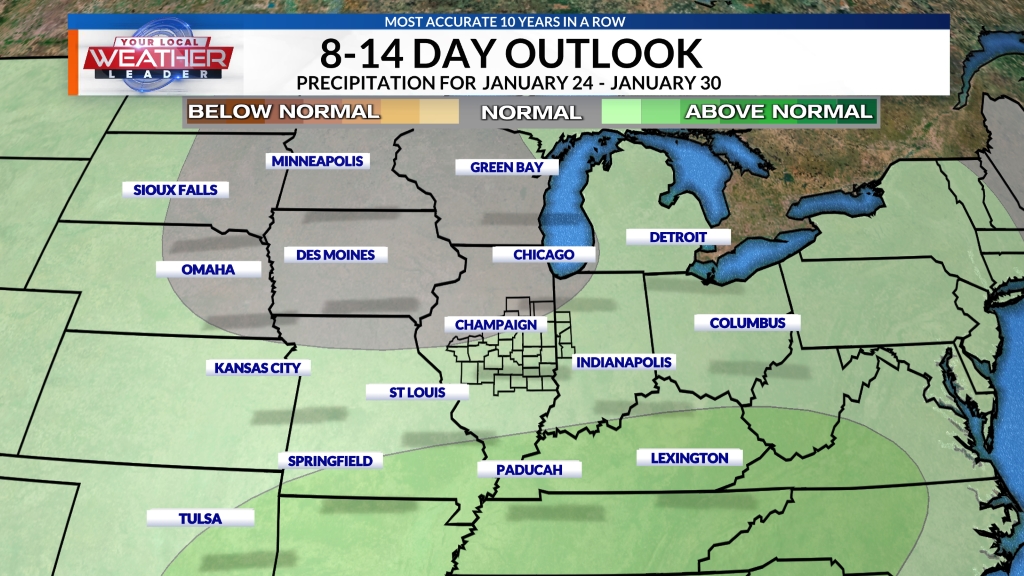
LONG-TERM FORECAST:
Here are the latest extended outlooks for the 8-14 day temperature and precipitation forecasts. These outlooks are issued daily and provide insight into the confidence of experiencing temperatures and precipitation above or below normal beyond our 7-day forecast.
 Copyright 2025 Nexstar Media, Inc. All rights reserved. This material may not be published, broadcast, rewritten, or redistributed.
For the latest news, weather, sports, and streaming video, go to WCIA.com.


0 komentar:
Posting Komentar